- China in European maps : a library special collection
- 大清一統天下全圖
- Universal map of the Qing Empire
- 朱錫齡
- production date not identified
- 1818
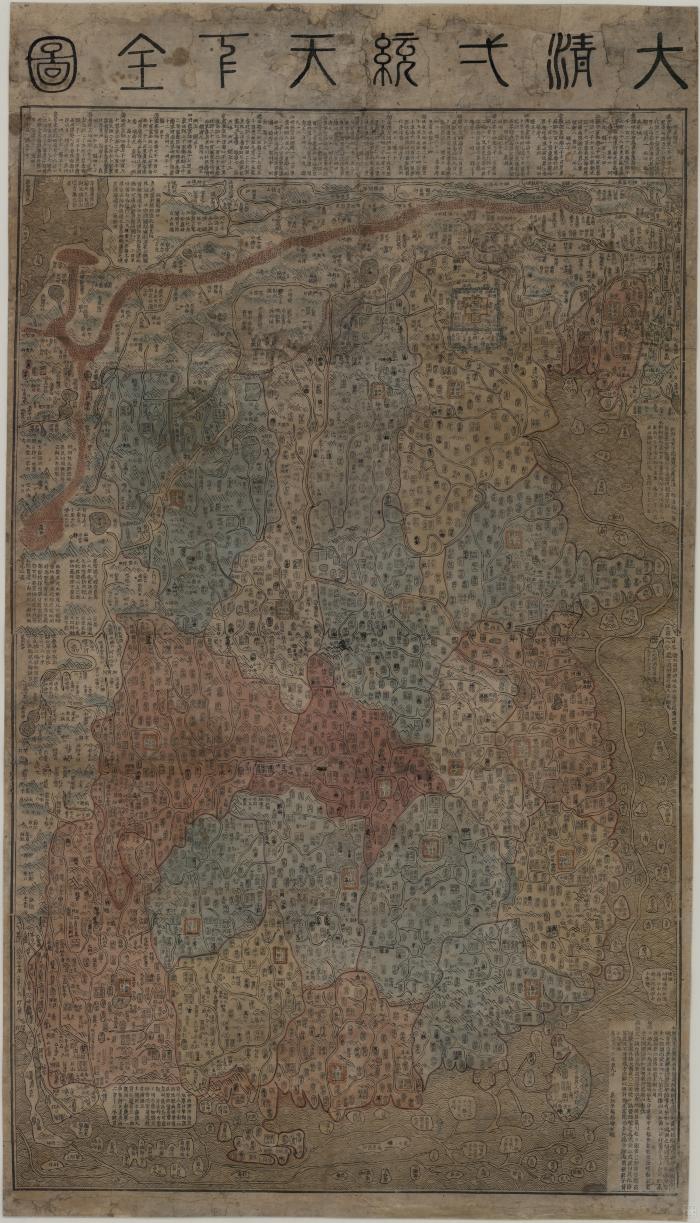
This map, showing the territory of the Qing Dynasty, was made by Zhu Xiling in 1818. The Great Wall, Lop Nur Desert, the provincial divisions, capitals, cities and towns, military outposts, and main waterways and rivers are all clearly delineated. America and other Western countries are represented as an array of vague and inconsequential islands along the border of the main landmass.
- Not drawn to scale.
- Electronic reproduction. Hong Kong : Hong Kong University of Science and Technology Library, [2022].
- Originally created as: 1 map, hand color ; 110 x 63 cm, woodblock prints.
- Includes list of administrative subdivisions of each province and other descriptive text.
- Relief shown pictorially.
- Title from "China in European maps", p.174 : 大清一統天下全圖 = Universal map of the Qing Empire.
- Aspect ratio: 1:0.572.
- Description based on print version record.
- G7820 1818 .C48er
- 中國
- China
- 朱錫齡繪
- Chinese
- 1 online resource (1 map)
- 10.14711/spcol/991011100489703412
- https://digitalcollections.hkust.edu.hk/Detail/objects/991011100489703412