- Rapkin, J.
- Winkles, Henry, 1800-approximately 1860
- Scale [approximately 1:22,000].
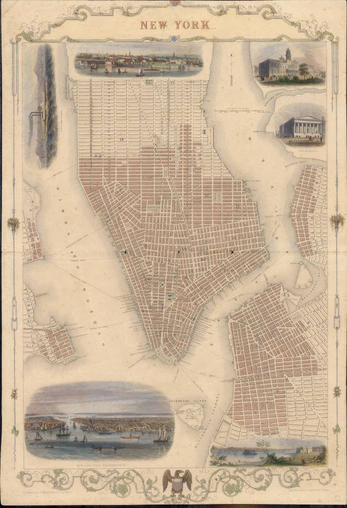
- Shows Manhattan from 42nd St. south to the Battery, with Governors Island and parts of Jersey City, Hoboken, Williamsburg, and Brooklyn.
- Shows wards.
- Inset views: A New York steamer -- Brooklyn -- City Hall -- Custom House -- The Narrows from Fort Hamilton -- New York from Williamsburgh.
- Electronic reproduction: Hong Kong University of Science and Technology Library, [2022].
- Originally created as: 1 map : color illustrations ; 44 x 32 cm.
- Aspect ratio: 1:1.462.
- Description based on physical version.
- New York (N.Y.)
- Brooklyn (New York, N.Y.)
- the plan drawn & engraved by J. Rapkin ; the illustrations drawn & engraved by H. Winkles
- 1 online resource (1 map : color illustrations)
- 10.14711/spcol/991013158524103412
- https://digitalcollections.hkust.edu.hk/Detail/objects/991013158524103412