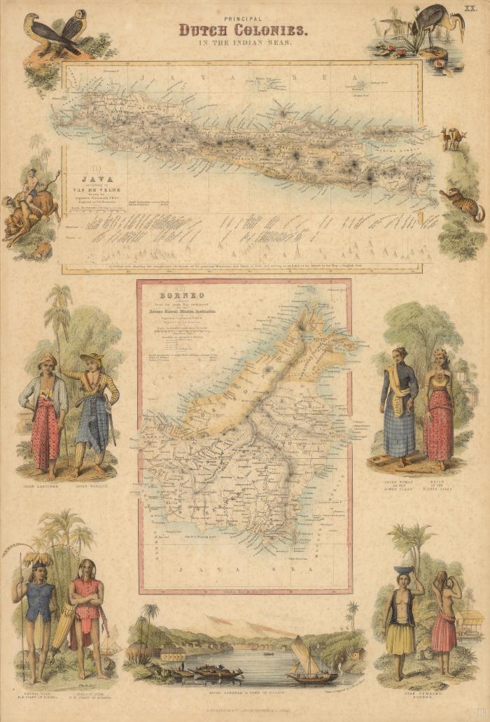
- Java according to Van de Velde
- Borneo
- Petermann, A. 1822-1878
- Swanston, George H.
- Velde, Charles William Meredith van de, 1818-1898
- Thom, A. M. Fullarton
- A. Fullarton & Co.
- 1872?
- Scale 1:4,200,000
- Scale 1:8,000,000. Nearly 110 G[erman] miles to 1 inch
- Relief shown by hachures.
- From Royal illustrated atlas of modern geography. Plate XX.
- Inset: Sectional view showing the comparative elevations of the principal mountains and places of Java ...
- Illustrations in margin: [Birds, animals] -- Javan labourer, Javan warrior -- Javan woman of the lower class, Bride of the higher class -- Saghai Dyak, S.E. coast of Borneo, Serebis Dyak, N.W. coast of Borneo -- River Sarawak & town of Kuchin / drawn & engraved by A. Thom -- Dyak females, Borneo.
- Java according to Van de Velde / drawn by Augustus Petermann ; engraved by G.H. Swanston -- Borneo : reduced from the large map constructed for the Borneo Church Mission Institution / by Augustus Petermann ; engraved by G.H. Swanston.
- Electronic reproduction: Hong Kong University of Science and Technology Library, [2022].
- Originally created as: 2 maps on 1 sheet : hand colored ; 14 x 23 cm and 20 x 14 cm, on sheet 48 x 33 cm.
- Aspect ratio: 1:1.475.
- Description based on physical version.
- G8090 1872 .P48er
- Java (Indonesia)
- Borneo
- English
- 1 online resource (2 maps on 1 sheet : hand colored)
- 10.14711/spcol/991013158533903412
- https://digitalcollections.hkust.edu.hk/Detail/objects/991013158533903412