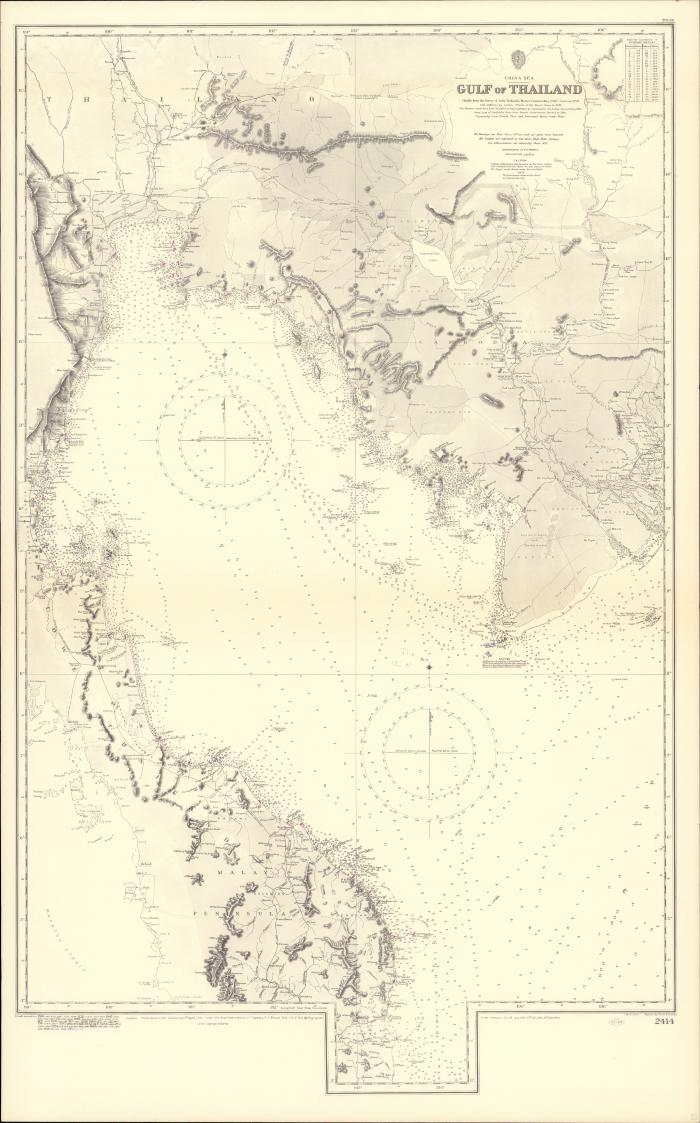
- Gulf of Thailand
- Richards, John
- Evans, F. J. 1815-1885
- Great Britain
- Davies & Company
- Admiralty
- 1945
- Scale 1:13,440,00.
- "With additions by various officers of the Royal Navy to 1938. The western coast from Lem Chong Pra to Tanjong Patani by commander A.J. Loftus, Sianmese Navy, 1872. Coast east of Cambodia point from French Government Survey to 1863. Topography from French, Thai and Federated Malay States Maps.".
- "Published at the Admiralty 1st April 1881, under the superintendence of captain F. J. Evans R.N. C.B. F.R.S. hydrographer.".
- "Longitude east from Greenwich.".
- Relief shown by hachures and spot heights; depths by soundings.
- Soundings in fathoms, heights in feet.
- Magnetic variation compass.
- Includes table for conversion of fathoms.
- "In upper right corner: 279.56 ; in lower right corner: 2414.".
- Electronic reproduction: Hong Kong University of Science and Technology Library, [2022].
- Originally created as: 1 map ; 105 x 64 cm, on sheet 113 x 70 cm.
- Aspect ratio: 1:1.604.
- Description based on physical version.
- G8027.T523P5 1945 .G7er
- Nautical charts
- Thailand, Gulf of
- chiefly from the survey of John Richards, Master Commanding H.M.S. Saracen, 1859 ; engraved by Davies & Company
- English
- 1 online resource (1 map)
- 10.14711/spcol/991013158896903412
- https://digitalcollections.hkust.edu.hk/Detail/objects/991013158896903412