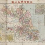
- 亞新地學社
- 亞新地學社
- 民國26 [1937]
- Scale 1:1,100,000 (E 116°--E 123°/N 35°--N 31°)
- Includes insets of 上海市街道圖, 淞滬形勢圖, 下關浦口街道圖, 南京市街道圖, 鎮江省會街道圖, 吳縣城街道圖
- G7823.J48 1937 .Y3
- Jiangsu
- China
- 江蘇
- 中國
- Chinese
- 1 map : col. ; 47 x 72 cm., folded to 28 x 20 cm
- 10.14711/spcol/b1186006
- https://digitalcollections.hkust.edu.hk/Detail/objects/b1186006