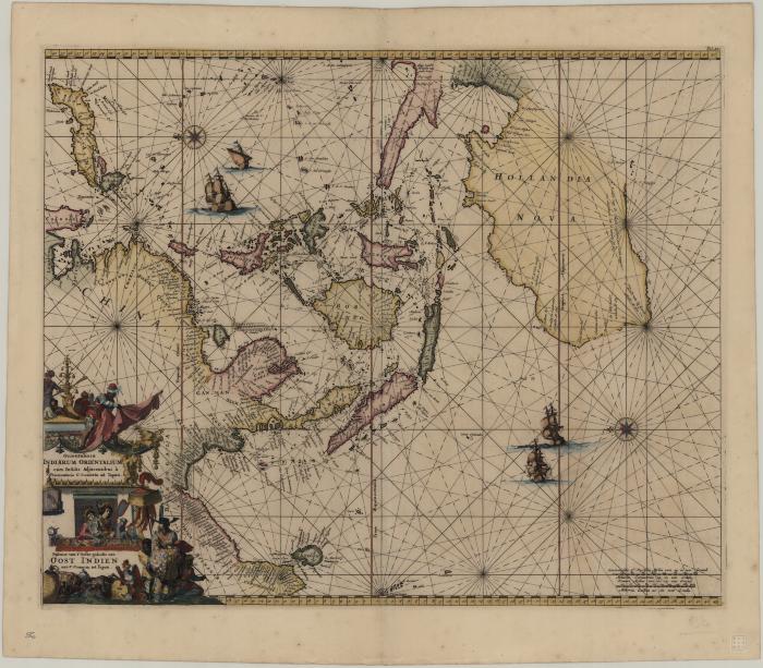
- At head of title: Orientaliora Indiarum Orientalium cum insulis adjacentibus à promontorio C. Comorin ad Iapan
- Goos, Pieter, approximately 1616-1675
- Wit, Frederik de
- F. de Wit
- 1680?
Also known by the title, "Orientaliora Indiarum Orientalium cum Insulis Adjacentibus a Promontorio C. Comorin ad Iapan". This navigational chart of East Asia, Southeast Asia, and Australia was published in de Wit's "Maritime Atlas" of 1680. Note the unusual "sideways" projection with north on the left of the page and the increasingly complete outline given to western and northern Australia, a century before Captain Cook.
- Scale ca. 1:17,250,000
- Hand colored
- Oriented with north to the left
- Navigational chart
- G8001.P5 1680 G66
- Nautical charts
- Southeast Asia
- Dutch
- 1 map : hand col. ; 45 x 55 cm
- 10.14711/spcol/b536700
- https://digitalcollections.hkust.edu.hk/Detail/objects/b536700