- Linschoten, Jan Huygen van, 1563-1611
- Cornelis Claesz
- 1596?
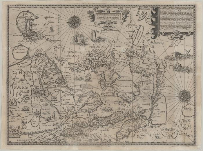
This chart was published in Van Linschoten's "Itinerario", one of the most important Dutch accounts of Portuguese Asia. Linschoten lived and worked in Goa during the 1580's in the service of the Archbishop of Goa. The map is oriented with west at the bottom of the page and covers the Malay Peninsula and Singapore, all of the Philippine Islands and China. Korea is shown as a circular island and Japan has a curious shrimp-like outline for mainland Honshu.
- Scale ca. 2 cm. = 35 German miles
- Relief shown pictorially
- Oriented with North to the left
- Published in the author's Itinerario
- G8001.P5 1596 .L55
- Nautical charts
- Southeast Asia
- China Sea
- Dutch
- 1 map ; 40 x 53 cm
- 10.14711/spcol/b536705
- https://digitalcollections.hkust.edu.hk/Detail/objects/b536705