- Anville, Jean Baptiste Bourguignon d', 1697-1782
- H. Scheurleer
- 1737
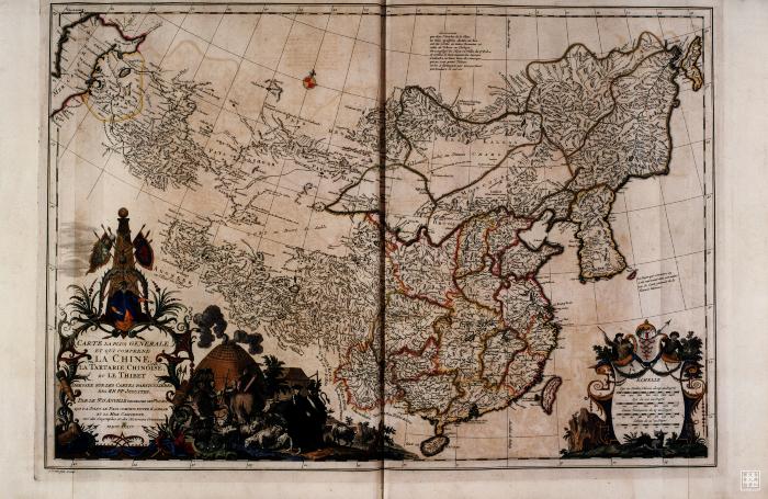
A general map of China, Korea, Tartary and Tibet, extending from the Eastern shores of the Caspian Sea along the route of the old Silk Road to China, Korea and Sakhalin. Includes also Hainan and Formosa. With a wonderfully elaborate and decorative cartouche which includes illustration of Tartar warriors with their sheep flocks and famous tents. Also illustrated are two Jesuit missionaries. The title cartouche is surrounded by boracque and Chinoiserie motifs and surmounted by the figure of the Chinese Emperor.
- Scale ca. 1:10,000,000
- Relief shown pictorially
- Hand colored
- Shows drainage, political boundaries, etc
- Prime meridian: Peking
- Appeared in the author's Nouvel atlas de la Chine, 1737
- DS708 .D85 1737 map 1
- China
- Mongolia
- Xizang
- Korea
- 中國
- 蒙古
- 西藏
- par le Sr. d'Anville geographe ordre du Roi, qui y a joint le pays compris entre Kashgar et la Mer Caspienne tiré des geographes et des historiens orientaux MDCCXXXII
- French
- 1 map : line col. ; 47 x 69 cm
- 10.14711/spcol/b649081
- https://digitalcollections.hkust.edu.hk/Detail/objects/b649081